


Metrikler
Yayın
23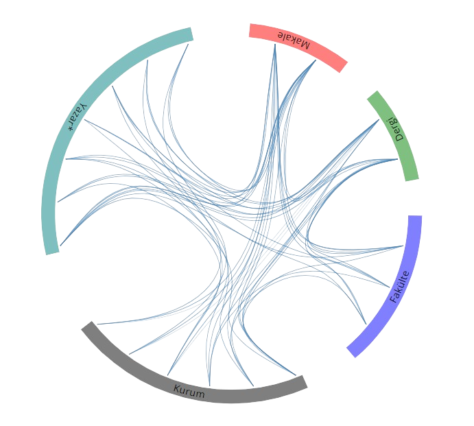
Açık Erişim
2
BM Sürdürülebilir Kalkınma Amaçları


Eğitim Bilgileri
2015 - 2022
2015 - 2022Doktora
Yıldız Teknik Üniversitesi, İnşaat Fakültesi, Harita Mühendisliği, Türkiye
2014 - 2015
2014 - 2015Yüksek Lisans
Yıldız Teknik Üniversitesi, İnşaat Fakültesi, Harita Mühendisliği, Türkiye
2006 - 2011
2006 - 2011Lisans
Karadeniz Teknik Üniversitesi, Mühendislik Fakültesi, Harita Mühendisliği, Türkiye
Araştırma Alanları
3B-Modelleme
Harita Mühendisliği-Geomatik
Arazi Yönetimi
Arsa-Arazi Yönetimi
Kentsel Alan Düzenlemesi
Kırsal Alan Düzenlemesi
Tapu-Kadastro
Taşınmaz Değerlemesi
Coğrafi Bilgi Sistemleri
Arazi Bilgi Sistemleri
Kent Bilgi Sistemleri
Konumsal Veri Altyapıları
Mühendislik ve Teknoloji
Akademik Ünvanlar / Görevler
2022 - Devam Ediyor
2022 - Devam EdiyorAraştırma Görevlisi Dr.
Atatürk Üniversitesi, Mühendislik Fakültesi, İnşaat Mühendisliği
2014 - 2022
2014 - 2022Araştırma Görevlisi
Yıldız Teknik Üniversitesi, İnşaat Fakültesi, Harita Mühendisliği
2019 - 2020
2019 - 2020Araştırmacı
Universiteit Twente, International Institute of Geo-Information Science and Earth Observation ITC
Makaleler
Tümü (11)
SCI-E, SSCI, AHCI (9)
SCI-E, SSCI, AHCI, ESCI (9)
Scopus (9)
TRDizin (2)
2024
20241. A holistic approach proposal for 3D underground land management (3D ULA) in Turkey: The case of utility network
GÜRSOY SÜRMENELİ H., Sun J., ALKAN M.
TRANSACTIONS IN GIS
, cilt.28, sa.7, ss.2134-2156, 2024 (SSCI, Scopus)


2023
20232. Spatial-Land Use Planning System Data Model Proposal for Edition II of LADM
Yilmaz O., Gürsoy Sürmeneli H., Alkan M.
GEOCARTO INTERNATIONAL MULTI-DISCIPLINARY JOURNAL OF REMOTE SENSING AND GIS
, cilt.38, sa.1, ss.1-24, 2023 (SCI-Expanded, Scopus)

2023
20233. Modelling of spatial planning systems with LADM standard: the case in Turkish regulatory planning system
Yilmaz O., Gürsoy Sürmeneli H., Alkan M.
SURVEY REVIEW
, cilt.1, sa.1, ss.1-16, 2023 (SCI-Expanded, Scopus)
2022
20224. The Application Domain Extension (ADE) 4D Cadastral Data Model and Its Application in Turkey
Surmeneli H., Koeva M., ALKAN M.
LAND
, cilt.11, sa.5, 2022 (SSCI, Scopus)

2022
20225. Design and implementation of a 4D cadastral legal model for Turkish land administration infrastructure based on LADM
Surmeneli H., Alkan M., Koeva M.
GEOCARTO INTERNATIONAL
, cilt.37, sa.26, ss.12096-12118, 2022 (SCI-Expanded, Scopus)
2021
20216. Towards standardisation of Turkish cadastral system using LADM with 3D cadastre
Surmeneli H., Alkan M.
SURVEY REVIEW
, cilt.53, sa.381, ss.543-558, 2021 (SCI-Expanded, SSCI, Scopus)
2021
20217. Design and development 3D RRR model for Turkish cadastral system using international standards
ALKAN M., Gursoy Surmeneli H., Polat Z. A.
SURVEY REVIEW
, cilt.53, sa.379, ss.312-324, 2021 (SCI-Expanded, Scopus)
2020
20208. Modelling of Temporal Query of 3D Legal Objects in Turkey
Alkan M., Sürmeneli H. G.
Türk Uzaktan Algılama ve CBS Dergisi
, cilt.1, sa.2, ss.125-136, 2020 (TRDizin)

2020
20209. 3D cadastral standard definition and development using international standards for Turkey cadastral system
Alkan M., Surmeneli H.
Jeodezi ve jeoinformasyon dergisi (Online)
, cilt.7, sa.1, ss.70-85, 2020 (TRDizin)
2018
201810. Development of an advertisement tax system based on a geographic information system
ALKAN M., Surmeneli H.
PROCEEDINGS OF THE INSTITUTION OF CIVIL ENGINEERS-MUNICIPAL ENGINEER
, cilt.171, sa.2, ss.93-104, 2018 (SCI-Expanded, Scopus)
2017
201711. Determining strategies for the cadastre 2034 vision using an AHP-Based SWOT analysis: A case study for the turkish cadastral and land administration system
Polat Z. A., ALKAN M., Surmeneli H.
LAND USE POLICY
, cilt.67, ss.151-166, 2017 (SSCI, Scopus)
Hakemli Bilimsel Toplantılarda Yayımlanmış Bildiriler
2024
20241. Comparative Performance Analysis of Türkiye's Land Management System Using SWOT Analysis Method
Gürsoy Sürmeneli H.
Proceedings of the International Conference of Contemporary Affairs in Architecture and Urbanism-ICCAUA, Antalya, Türkiye, 22 - 24 Mayıs 2024, cilt.7, sa.1, ss.540-550, (Tam Metin Bildiri)

2022
20222. Towards Investigation of Integrating LADM, BIM, and CityGML of 3D Condominium Rights for Cadastral Purposes: The Case of Turkish Cadastral System
GÜRSOY SÜRMENELİ H., ALKAN M., KOEVA M.
The 10th Land Administration Domain Model Workshop, FIG, Dubrovnik, Hırvatistan, 31 Mart 2022, (Tam Metin Bildiri)
2021
20213. A COMPARISON OF TURKEY-MALAYSIA LADM COUNTRY PROFILE FOR 3D CADASTRE PURPOSES
GÜRSOY SÜRMENELİ H., ALKAN M., RAHMAN A. A.
International Conference Geospatial Asia-Europe 2021, Marrakush, Fas, 5 - 06 Ekim 2021, ss.1-7, Malezya, 05 Ekim 2021, (Tam Metin Bildiri)
2021
20214. Integration of LADM and CityGML for 3D Cadastre of Turkey
GÜRSOY SÜRMENELİ H., ALKAN M., KOEVA M.
3D GEOINFO AND 3D CADASTRE, New York, Amerika Birleşik Devletleri, 11 - 14 Ekim 2021, ss.309-323, 11 Ekim 2021, ss.309-323, (Tam Metin Bildiri)
2019
20195. INVESTIGATING FOR 3D TURKEY CADASTRE WITH INTERNATIONALSTANDARDS
ALKAN M., GÜRSOY SÜRMENELİ H.
6th International Conference on Geomatics and Geospatial Technology (GGT 2019), 1 - 03 Ekim 2019, (Tam Metin Bildiri)
2018
20186. Design and Determine 3D Cadastral Systems: A Case Study of Turkey
GÜRSOY SÜRMENELİ H., ALKAN M.
6th International FIG 3D Cadastre Workshop, 2 - 04 Ekim 2018, (Tam Metin Bildiri)
2018
20187. Design and Determine Cadastral and Land Management Performance of Turkey with Cadastre 2034 Vision
ALKAN M., GÜRSOY SÜRMENELİ H., POLAT Z. A.
XXVI FIG Congress, 6 - 11 Mayıs 2018, (Tam Metin Bildiri)
2018
20188. How To Be Created A New Terminology For 3- and 4- Dimensional Cadastre In Turkey
GÜRSOY SÜRMENELİ H., POLAT Z. A., ALKAN M.
XXVI FIG Congress, 6 - 11 Mayıs 2018, (Tam Metin Bildiri)
2018
20189. Bibliometric Analysis of Articles Presented Under Commission 7: a Case of the 25th Fig Congress in Malaysİa in 2014
POLAT Z. A., GÜRSOY SÜRMENELİ H., ALKAN M.
XXVI FIG Congress, İstanbul, Türkiye, 4 - 11 Mayıs 2018, (Tam Metin Bildiri)
2017
201710. Modelling Land Registry and Cadastre Transactions with UML: A Case of Turkey
POLAT Z. A., GÜRSOY SÜRMENELİ H., ALKAN M.
International Symposium on GIS Applications in Geography and Geosciences, ÇANAKKALE, 18 Ekim - 21 Aralık 2017, (Tam Metin Bildiri)
2017
201711. ”Desing and Development of an Spatial Advertisement Tax System
GÜRSOY SÜRMENELİ H., ÇOLAK H. E., ALKAN M.
International Symposium on GIS Applications in Geography and Geosciences, ÇANAKKALE, TÜRKIYE, 18 - 21 Ekim 2017, (Tam Metin Bildiri)
2017
201712. WEB TABANLI COĞRAFİ BİLGİ SİSTEMİ YTÜ İNŞAAT FAKÜLTESİ UYGULAMASI
GÜRSOY SÜRMENELİ H., DUMAN H., GÜMÜŞAY M. Ü.
6. TÜRKİYE HARİTA BİLİMSEL VE TEKNİK KURULTAYI, Türkiye, 3 - 06 Mayıs 2017, (Tam Metin Bildiri)
Desteklenen Projeler
2021 - 2022
2021 - 2022
3B arazi yönetimi kapsamında bina verisi üzerinden LADMCityGMLBIM kullanılarak yeni bir entegre veri modelinin geliştirilmesi
Yükseköğretim Kurumları Destekli Proje , BAP Araştırma Projesi
(Proje Özeti)
Alkan M.(Yürütücü), Gürsoy Sürmeneli H., Polat Z. A.
Burslar
2019 - 2020
2019 - 2020